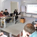
An intensive training course for the project partners within the Balkan Lynx Recovery Programme on basics of geographical information systems and cartography took place from 14-16 December 2016. The training, held in the premises of PPNEA, in Tirana, was implemented by the Macedonian Ecological Society, and attended by three PPNEA members and two members of ERA from Peć, Kosovo.
Four presentations were given at the beginning of the training, with the major section consisting of demonstration and practical work by participants on numerous selected GIS aspects deemed crucial for the Programme (georeferencing, transformation of geographical projections, digitalisation, data display and labelling, map preparation, etc.). In addition, participants were acquainted with the use of several applications intended for mobile devices and their application in the field. In that respect, participants were trained on advanced use of GPS, database setting for mobile devices depending on individual needs during field research, adaptation of “external” data into GIS format, etc.
In the course of the training ArcGIS, QGIS, Microsoft Excel, and Google Earth and other Windows software packages were used, as well as the Android mobile applications Oruxmaps, MEMENTO Database, ES File Explorer, and Mapfactor Navigator.


